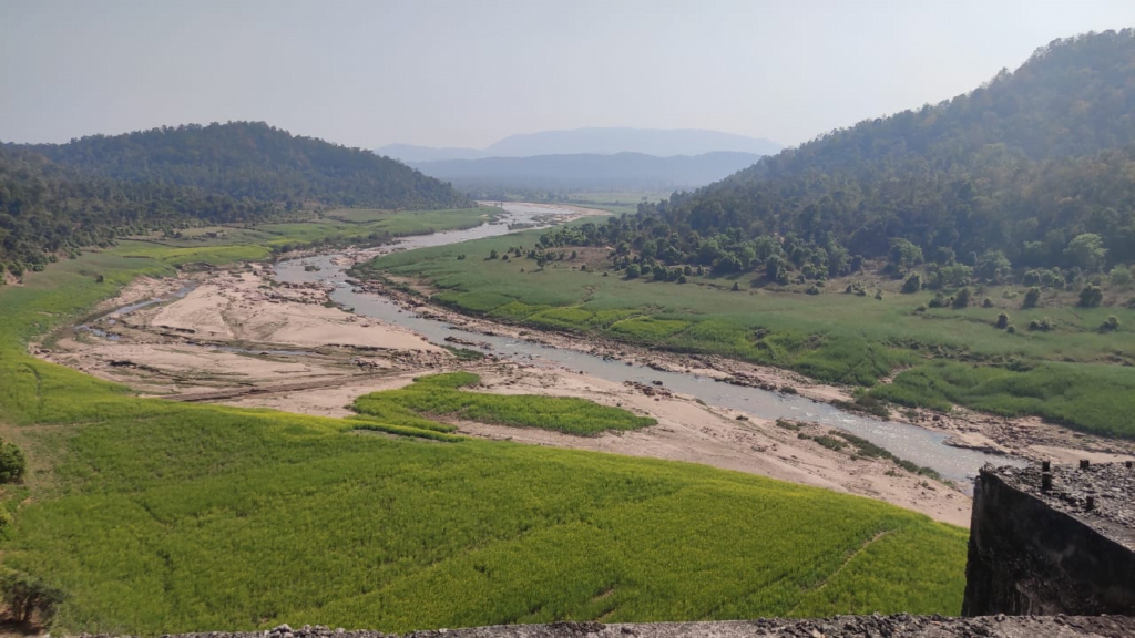
North Koel River: A Snapshot of its Course, Tributaries, and Projects
The North Koel River, situated in the Indian state of Jharkhand, is a significant geographical feature that winds its way through the region. This article sheds light on its origin, trajectory, tributaries, and the North Koel Project.
Origin and Course
The North Koel River originates from the Chhota Nagpur plateau, specifically Chulha Pani in the Lohardaga district of Jharkhand. Its source coordinates are 23°38′09″N 84°41′05″E. The river’s journey commences in the Latehar district, just below Netarhat near Rud. Initially, it flows approximately westward for a distance of around 32 kilometers (20 miles), before dramatically veering northward at a near right angle. The river courses through a gorge at Kutku and continues through the heart of the district until it eventually meets the Son River a few miles to the northwest of Haidarnagar.
Length and Significance
Spanning a length of about 360 kilometers (220 miles), the North Koel River plays a pivotal role in the region’s hydrology. With a catchment area of at least 9,100 square kilometers (3,500 square miles), it significantly contributes to the Son River’s water levels during the monsoon season. However, during other times of the year, its depth might not accommodate even small cargo boats to travel upstream to Daltonganj. The river boasts picturesque landscapes and even breathtaking sights like the rocky bed and rapids north of Hutar and the Kutku gorge.
Tributaries and Natural Beauty
The North Koel River is graced by several tributaries, with the Auranga and Amanat rivers joining it from the east – the former at Kechki, 16 kilometers (10 miles) south, and the latter 8 kilometers (5 miles) north of Daltonganj. Another noteworthy tributary, the Burha River, merges with the North Koel above Kutku at Bagechampa. This network of tributaries contributes to the river’s unique charm as it winds its way through the northern portion of Betla National Park.
The North Koel Project and its Impact
The North Koel Project, situated near Kutku in the Mandal region, is a significant endeavor in the area. Featuring a 64.82-meter (212.7-foot) high dam, this project aims to release water for the Mohammadganj Barrage and Indrapuri Barrage. Dubbed the Kutku Dam, it has the potential for hydro-electric power generation of 2 x 12 MW. However, this project isn’t without its challenges, as it would lead to the flooding of 56 villages. Notably, eight of these villages lie within the core area of the Palamau Tiger Reserve.
Challenges and Progress
Initiated in 1974, the North Koel Project was envisioned to irrigate substantial farmland areas and provide benefits to neighboring regions in both Jharkhand and Bihar. However, hurdles arose, including environmental concerns and forest conservation regulations. Despite reaching 90% completion by 1993, the project was halted due to the tightening of forest clearance regulations, specifically related to nature reserves and national parks. The unfinished dam, standing at a height of 67.86 meters and length of 278 meters, stands as a testament to this unfinished ambition.
Local Voices and Considerations
The project’s impact on local communities has been varied. Compensation was provided to a majority of families from submerged villages, yet there remain concerns among those who didn’t receive due compensation or whose ancestors received it. The inhabitants emphasize that adequate reparation is vital to address the hardships they might face due to the project. While many are not fundamentally against the project, they seek assurance that its promised benefits, including land irrigation and hydro power generation, reach them.
Looking Ahead
It becomes crucial for the government to ensure that the project’s benefits indeed reach the local populace. Furthermore, adequate compensation and rehabilitation measures should be established prior to any displacement. Achieving this requires engagement and consensus-building with the local communities, ultimately fostering a balanced approach that benefits both the region’s development and the well-being of its inhabitants.
North Koel Resevoir Project

The Union Minister of Water Resources has urged for the acceleration of the North Koel Reservoir project in Jharkhand, which has remained pending since 1972.
Overview:
Situated in the Palamau and Garhwa districts of Jharkhand State, the North Koel Reservoir project is centered around the North Koel River, a tributary of the Sone River that eventually converges with the Ganges.
Key Components:
The project comprises several major components:
- Mandal Dam
- Mohammadganj Barrage (located 96 km downstream from the dam)
- Two canals originating from the Mohammadganj Barrage, supported by a network of distributaries designed for irrigation purposes.
The project’s primary objective is to facilitate irrigation in the drought-prone areas of Palamu and Garhwa districts in Jharkhand, as well as Aurangabad and Gaya districts in Bihar.
Project Timeline:
The initial construction efforts began in 1972 and continued until 1993. However, the work was halted by the Forest Department of the Bihar Government in order to safeguard the Betla National Park and the Palamau Tiger Reserve from submergence. Since then, progress on the dam has been at a standstill.
In August 2017, the Union Cabinet sanctioned a proposal to complete the remaining tasks of the North Koel reservoir project. The estimated cost for this completion was set at Rs 1622 crore.


